Severe storms impacted central Minnesota last night and early this morning with large hail and vivid lightning. It was another great opportunity for a local chase.
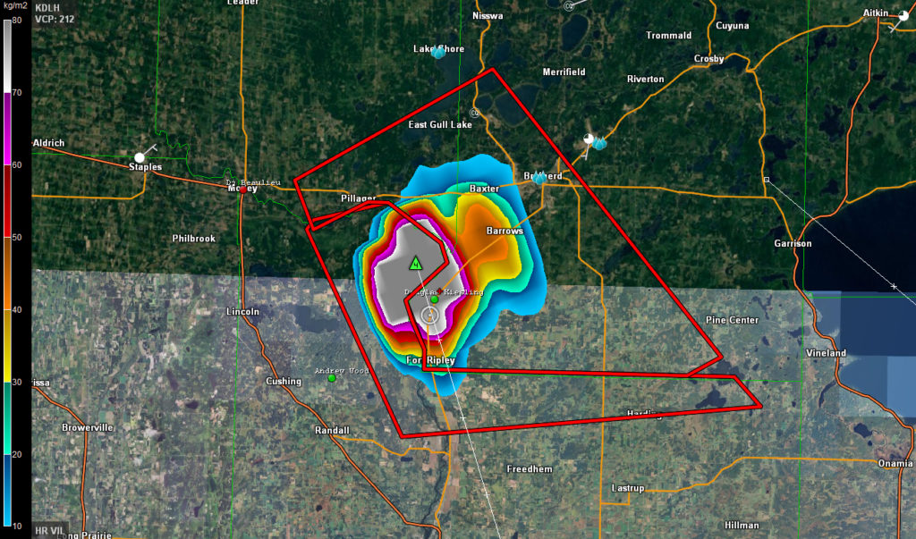
While I was busy during the day and was not able to make it up north for the chase in the afternoon, I was able to make it up for the chase in the evening. Before I made it to Brainerd, MN, the VIL or Vertically Integrated Liquid was in the extreme range on radar and it looked like I was in for some fun. The down side was that it was going to happen after dark and no city or town would be in the path of the core.

In the image above, if you right click on it and view the full size version, you can see that a hail core with possible 4″ diameter hail was right on top of me. Knowing the storm setups up here and this time of year, I doubted the radar data was accurate. When the hail core hit, I was right, it was extremely heavy rain and golf ball sized hail. Still pretty intense hail but not softball size.
I played with this storm for a while and then drove home to Saint Cloud, MN where I waited for the next round of storms with some pretty vivid lightning. The lightning in the video is pretty intense and looks great in real time in the footage.
