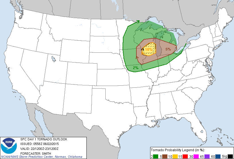
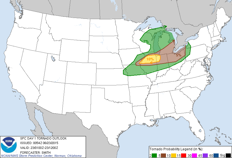
I think I have maybe got 4 hours of sleep in the last day and a half. I’m saying today but in reality it is yesterday that I’m talking about in this post, excuse the really tired blogging 🙂 It all started on Sunday as the Hype Train was getting going for the forecast, which is still today for me but in reality is yesterday, for the area in Southern, IL. The hype was for the 10% hatched forecast tornado area that SPC put out for the area which on paper looks good but doing my own forecast and from experience, looked too good to be true.

The forecast went from the graphic above to the graphic below.

Now before anyone gets pissy, I’m not bitching about the SPC forecast. The 10% hatched looked to be valid before the monster high speed MCS from the early morning storms this morning, correction, yesterday morning, plowed through southern Minnesota and northern Iowa.
The morning storms really did a number on the forecast but I had a feeling they would and the forecast was also for Wisconsin, which just sucks to chase in anyway, due to the hills and trees. Everything shifted south into Illinois and honestly, I have better things to do then drive to Illinois when I already had a full plate of stuff to document in Minnesota.
First up, today’s, I did it again, YESTERDAYS early morning storms were amazing to watch.
The lightning was just simply amazing and at one point was more like a night club with the strobe effect from the flashing in the sky.
I drove out to Madison, MN which is on the Minnesota and South Dakota boarder as the storms were pretty much just getting going and provided an amazing light show for about half an hour before sunrise. At Sunrise, everything clicked and the storms raced off to the east faster then I could keep up. I drove home and took care of some work until the next big show started up in Iowa and Illinois and worked the desk until I was finally able to take a nap for an hour, only to have Neva wake me up and say the sky looked insane and we needed to go see something Amazing, the Aurora Borealis.
A G4 Class Solar Storm with a Kp Index of 8 caused a geomagnetic storm that filled the sky over central Minnesota.
The auroras were extremely bright and filled the sky as they extended over head and moved into the southern half of the sky.
The sight was amazing and we found a couple new spots to view them from just north of town where we could avoid traffic and people coming up to us late at night wondering what we were doing. Also talking to my friends Amanda and Nick who were on vacation in North Dakota and they almost drove back yesterday to chase in the Wisconsin and Illinois mess, they finally got to see the amazing sights I always see living north of the Twin Cities metro area. Amanda has never seen them until this evening and while I was talking to Nick on the phone, all I could hear in the back ground was what sounded like when someone chases and finally sees their first LP supercell with a tornado. Yeah she was happy! Actually they were both happy for blowing off the chase to go for the secondary target and it paid off for them.
At the peak of the Auroras, one thing I noticed was that my cell phone was not working. It kept saying all circuits were busy. I wonder if the geomagnetic storm was hurting the communication satellites.
What about the primary target? One of my best friends in chasing, Chris Collura, got on the tornado in Illinois today and shot some amazing footage. Sorry YESTERDAY. Here is his video.
Yes there were storms, no I won’t even think twice about blowing them off if there is a chance I have to chase in Wisconsin.
