Yesterday I went on one of the many chases that “rumor” has it that I never do anymore since it was over 20 miles from home. The target area for me was well defined days in advance and in an area that I love to chase in, western Minnesota where visibility is not a problem with trees.
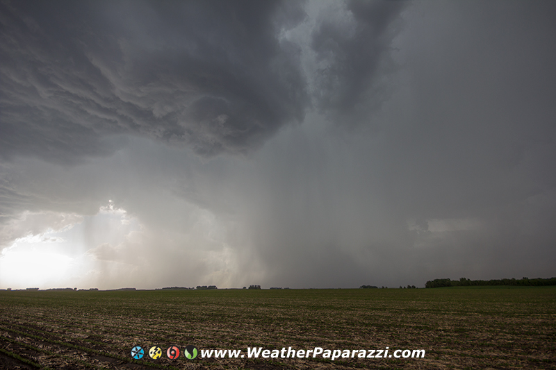
After helping Neva out with some much needed chores at home with the yard, I took off to drive out west towards my target area that was near Benson to Morris, MN. The storms were just firing up and were looking amazing as I pulled off to a safe parking spot off of the road so as to not block traffic or be in anyone’s way. A Pontiac pulled up and I was thinking great more locals to mess up my audio track on the video cameras. Turns out I had to apologize to some new chasers that showed up that I was kind of rude to at first. I thought they were locals just seeing what I was doing and I was telling them to get out of the area as the radar was showing 2″ hail just off to the west of our location.
We chatted for a few minutes before the rain started and the hail core was about to hit. I packed up my camera gear. I was heading west toward the storm when I noticed one small detail, I failed to stop and top off the fuel tank in Benson before I stopped to document the lightning. Whoops, I had to turn and head back to Benson for a fuel and then continue the chase.
After filling up the truck, the radar showed the storm split into two possible targets. One to my northeast and one to my southwest. The southwest target looked better on radar and was closer so I took the closest option. The storm looked decent and at one point the radar showed some rotation.

In the photo above, the rotation was very high based and before I could get the video cameras ready, the rotation faded away. I was driving south to try and get in front of the storm where I could see it but the dash camera was not able to get a decent view due to the antenna and window frame in the way. This is when I needed a chase partner to film out the passenger side. This storm pulsed up and looked good then within 15 minutes it started to weaken again.
The storm to my northeast pulsed and then weakened a little, only to build bake up and become a beast that moved off to east and it was in a area just south of home. I followed the storm back home but I knew that there was no way I could keep up or even get back into the storm. I was just enjoying the weather and the drive in the country as the temperatures dropped from 98F to 75F.
In the city of Paynesville, I found that power was out to part of the city as numerous tree’s and tree limbs were blown down by straight line winds that helped to knock down the power lines. Someone told me that the transformer at the hospital blew up due to the storm. The firefighters told me that in the Cenex parking lot on old highway 23, large semi tractor trailer was blown over on its side and lots of trees were on buildings on the north side of town. They were correct. I saw a lot of damage and it looked like the possibility a micro burst combined with a lot of lightning that hit the area as everything was blown in the same direction over a several block area. I did not see much damage near my brothers cabin and off to the east of town so the damage was localized to the city of Paynesville.
Here is the video from the chase.
