Ok, it’s been a while since I updated the blog so I wanted to get back on and posted a few quick updates before I crash for the night.
Been super busy with several tv show projects and helping them research footage. Can’t say what for now, but they will be out soon on cable.
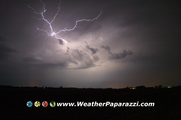
Next, been chasing storms when there within a few hours drive from home and working the news video with my video and the crews footage. I will be posting a lot of new blog videos later today after I get some sleep.
I’m still working on the news website but that is taking a lot longer then expected just do to the size of the database and layout. But it’s coming along.
I did take some time off this past weekend from being a workaholic and went fishing with Neva on Saturday and Sunday. Saturday we were up at the cabin up north but did not catch anything. Sunday, we got a lot of fish and I even got a Northern and a Large Mouth Bass. The Bass was… tasty, but the Northern got sent back to the deep. I am learning that I really need to push back the work and creative research and story research stuff along with running the daily stuff for BNVN because I can only do so much. It’s stressing me more and more lately trying to do way too much. I need a vacation…
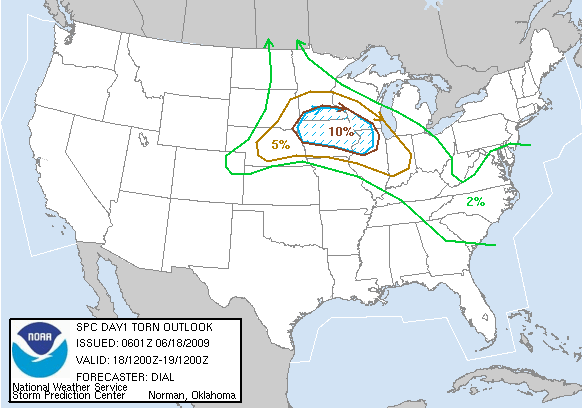
Today I did get out and into the field to go chasing but the storms sucked. I put on 679 miles on the truck to go from home to the middle of South Dakota, chase some tiny hailers then come right back home. All in all about a 12 hour round trip. As I was setting up for tomorrow, er, today’s storms and looked over the forecast, I ended up bailing on the storm setup and came home. The forecast was looking like an MCS and Bow Echo. I thought, I could bail on this, go home and chase the system when it shows up on Thursday.
Well, it’s almost 3:00 in the morning, yes, work-a-holic and I need to get cleaned up and get some sleep.